UK Snow Alert issued – Heavy Snow expected tomorrow

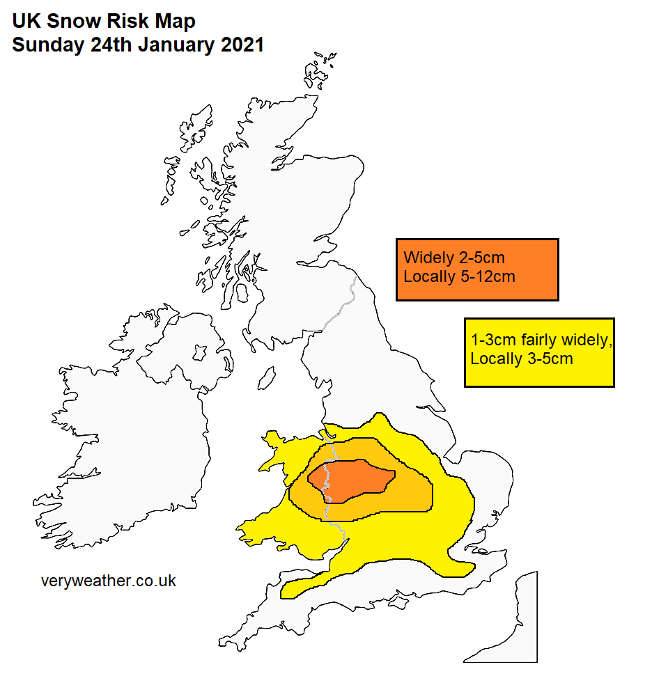
Some parts of the UK are forecast snow tomorrow which could be quite heavy and slow moving in places. Our snow risk map which highlights where the snow is forecast tomorrow is available below, please use this as a guidance as to where the heaviest snow may fall. It is worth bearing in mind that even in the risk zones, there is some uncertainty with regards to how much snow will fall.
There is a risk of significant snow early on Sunday in Wales, potentially 2-5cm of snow with 5-10cm locally and over hills. The snow will eventually reach the Midlands, where it may become slow moving increasing the risk of high accumulations. Up to 12cm (5″) is possible locally over Shropshire, and other high parts of the West Midlands. Totals of 2-5cm are expected fairly widely in the Midlands. Nearer to the south coast, precipitation will fall as a sleet/rain mix with most of the snow confined to hills, however some wet snow to lower levels is possible temporarily to lower levels south of the M4. Snow accumulations away from 100m+ will also be limited in the South East.
The following snow risk map shows where the highest risk of snow is tomorrow.
